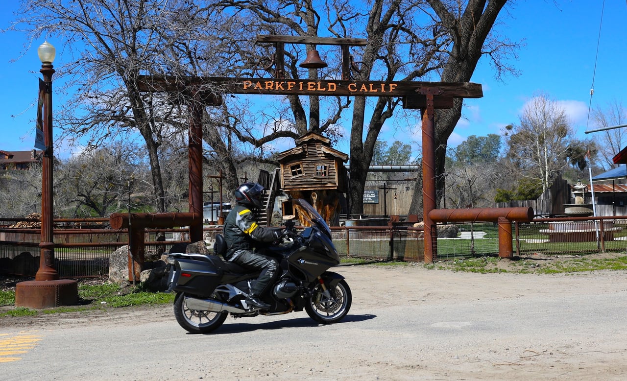
PARKFIELD, Calif. (CN) — On a recent Saturday afternoon, the tiny town of Parkfield, California, was typically quiet, though a few people were outdoors enjoying a break from a long, rainy winter.
After a scenic drive along Vineyard Canyon Road, a motorcyclist from Paso Robles stopped for a bite at the Parkfield Café. A Shandon school bus driver strolled through town pulled by a pony (“We’re getting ready for our first show.”) And, at a small bridge crossing the Cholame Creek, a middle-aged woman in a red Tesla stepped out of her car for a quick selfie beneath a sign denoting the San Andreas Fault.
While Parkfield (population: 18) is a tiny town, that sign has a giant profile.
“When I take my students on a field trip there, they always want to get a selfie with the sign,” said Julian Lozos, assistant professor of geophysics at California State University, Northridge.


There are actually signs at each end of the bridge, which crosses the tectonic boundary (the San Andreas Fault) between the constantly moving Pacific and North American plates. More than anything, the San Andreas Fault’s reputation as a major mover and shaker stems from the 1906 San Francisco earthquake, which killed 3,000 people and — less importantly — provided inspiration for the 2015 action movie “San Andreas” with Dwayne “The Rock” Johnson. Yet, because it experiences a significant quake roughly every 22 years, Parkfield, located 220 miles south of San Francisco, is referred to as the Earthquake Capital of the World.
“It’s a pretty well-deserved title,” Lozos said. “It’s a big deal for earthquake science.”
One of the longest faults in the world — extending over 800 miles — the San Andreas is divided into three segments, each with a different degree of earthquake risk. While the northern segment leveled San Francisco, the central segment at Parkfield garnered the attention of earthquake scientists in the 1980s for one notable distinction: similar earthquakes with a magnitude 6.0 or greater had occurred with regularity here, with large events in 1857, 1888, 1901, 1922, 1934, and 1966.
“I don’t think there is anywhere else where we get magnitude 6 earthquakes in a limited area on such a frequent basis,” said Andy Michael, a geophysicist with the U.S. Geological Survey’s Earthquake Science Center. “Some people would argue that earthquakes happen randomly, and we found the one place in the world where it looked like it was on a regular basis.”
With that in mind, earthquake scientists, including Michael, descended on Parkfield in the mid-80s to conduct the Parkfield Earthquake Experiment. As the name suggests, the goal was to figure out how to predict when the next Big One might strike. To do that, the scientists installed a massive amount of instrumentation in Parkfield, collecting data on the Earth’s movement. Knowing how consistent the quakes had been, scientists even predicted — with a 90-95% confidence level — that a big one would strike between 1985 and 1993.
As national media picked up on the prediction, local rancher Jack Varian and his son John took advantage of the burgeoning earthquake tourism, building the Parkfield Café (slogan: “Be here when it happens.”) and the Parkfield Lodge (“Sleep here when it happens.”)


After a magnitude 4.7 earthquake struck north of Parkfield in 1992, scientists issued a more precise alert that a big shaker would hit within 72 hours, drawing media from around the country. But what scientists discovered is that you can’t really predict an earthquake. To do so, Michael said, would require installing sensors deep into the earth, every few inches.
The next big earthquake didn’t hit Parkfield until 2004. But it did provide an opportunity for study.
“As an experiment it was successful because we have good data,” Michael said. “It was not successful in saying now we have a way to predict earthquakes. Because we can’t control that. We can only learn what the Earth actually does.”


