


PHILLIPS STATION, Calif. (CN) — Light snow fell Thursday as state workers began the third snow survey of the season.
By the time they finished, workers with the California Department of Water Resources advised people to get off the mountain where they performed the survey. The storm anticipated to last the weekend was rolling in, and they stood at almost 7,000 feet above sea level.
“It’s going to make travel really impossible,” said Angelique Fabbiani-Leon, a water resources engineer with the department. “Do not travel to the Sierra Nevada this coming weekend.”
The coming storm, while potentially dangerous to travelers, is welcome. The snowpack at Phillips Station stood at 47.5 inches — almost 4 feet — and holds 18 inches of water content, meaning if the snowpack melted 18 inches of water would remain.
That's 77% of average for the date, and 74% of average for April 1. Andy Reising, also a water resources engineer with the department, said April 1 is the benchmark because that’s typically when snowpack is at its peak.
“This year, 4 feet,” Reising said of the snowpack. “Last year, 9 1/2 feet."
Of the coming storm, he said: “It will be a good snow producer."
The department has electronic sensors placed throughout the state providing realtime data about snowpack. Statewide, California’s snowpack stood at 80% of average on Thursday — an increase from 58% of average on Feb. 1.
The numbers, while improving, pale when compared to last year. Snowpack topped 177% of average at Phillips Station this time last year. Statewide, it was 176%.
California has some 260 sites like Phillips Station, where snow surveys occur around the same time each year. The department performs its surveys at sites in January, February, March and April. Thursday’s survey counted as the one for March, as workers chose to perform it before the storm arrived.
David Rizzardo, a manager with the hydrology section of the department, said it’s essential to capture data during the same time period each year. There’s a 10-day window for each survey, and waiting until after the coming storm would have missed it. Also, the department doesn’t want to reflect the effects of one particular storm, but instead maintain consistency throughout its records.
The next survey is tentatively set for April 2.
“This storm may bring us to average and maybe above,” Reising said, though he cautioned that the state likely will need a number of additional storms in March to bring levels to the April 1 average.
Still, the state's reservoirs still hold much of the bounty of last year, with most above their respective historical averages on Thursday. Lake Shasta was at 83% of its total capacity, and 115% of its historical average. Lake Oroville stood at 84% of total capacity, and 133% for its historical average.
The National Weather Service has issued a blizzard warning from early Thursday to 10 a.m. Sunday. Forecasts call for 1 to 4 feet of snow above 3,000 feet through Sunday, with 5 to 10 feet possible above 5,000 feet and 12 feet or more over the peaks. Winds could gust to 75 mph or higher.
“These are phenomenal accumulations of snow,” said Michael Anderson, a state climatologist.
Only minor accumulation is expected around 2,000 feet, and rainfall in the Central Valley is expected to be moderate and unlikely to cause flooding.
Subscribe to Closing Arguments
Sign up for new weekly newsletter Closing Arguments to get the latest about ongoing trials, major litigation and hot cases and rulings in courthouses around the U.S. and the world.
Additional Reads
-

-
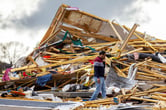 Homes, businesses damaged as tornadoes pummel Midwest April 26, 2024
-

-
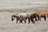 Horse protection April 26, 2024