 Search Articles

(CN) — An unusually strong atmospheric river parked itself over Northern California this weekend, shattering October precipitation records for places like San Francisco and set all-time rainy-day records in cities like Sacramento.
“This was a strong system in our area,” said Sean Miller, a forecaster with the National Weather Service. “The interesting fact is that the system came so early; it was anomalously strong for this time of year.”
Mt. Tamalpais in Marin County saw 16.55 inches of rain from the storm, while 10 inches of rain fell on the Santa Cruz Mountains over a 48-hour period — a staggering amount for a region ravaged by persistent dryness and forest fires for the past two years.
San Francisco recorded four inches of rain in the downtown area, making it the wettest October day in the city’s recorded history and the fourth wettest day ever. Also, San Francisco is presently experiencing the second wettest October in recorded history, with almost all the rainfall occurring on a single day.
Sunday was the wettest single day in the history of Sacramento, with 5.44 inches falling within a 24-hour period — breaking a record (5.28 inches) that stood since 1880. The city received 82% of the total rainfall that fell in the last water year which ended Sept. 30 in a single day.
Reno set a single-day October record of 2.82 inches and the rain was still falling as of Monday morning.
Rain turned to snow in the Sierra overnight and continued to fall at upper elevations as of 10 a.m. Monday. Some areas also saw record precipitation, including Blue Canyon, on Highway 80 between Sacramento and Truckee, which received 10.4 inches of precipitation — shattering the previous record of 9.33 inches.
Donner Pass gathered more than two feet of snow during the storm, with 29 inches falling on the highest point of Highway 80 in California. Kirkwood Ski Resort was a touch south of the main current of the atmospheric river, but still saw 15 inches of accumulation.
The Central Sierra Snow Lab reported the atmospheric river that dumped on Northern California already represents the second-snowiest October in the organization’s history of recording snow totals. It has so far recorded 41 inches of snowfall, with only 2004 exceeding the amount by nine inches. Palisades Tahoe reported a foot and a half of accumulation at the top of the resort.
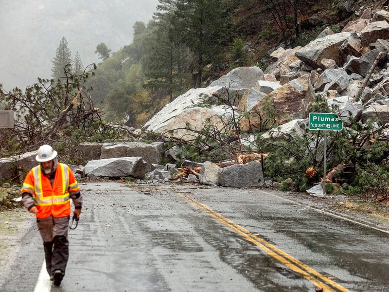
While forecasters had worried there would be flooding and mudslides in wildfire burn scars, problems did not materialize to the extent some had feared.
“I understand the concern because a lot of the vegetation holding the soil in place is gone in certain areas,” Miller said. “This means areas are going to be vulnerable to soil and rock movement, but it doesn’t sound like we are having big issues.”
Most of the flooding is of the nuisance variety, with large amounts of water in the streets due to clogged storm drains and a few downed trees, Miller said.
“We are not hearing of major trouble,” he said.
While the amount of moisture is enough to forestall any more major fires in Northern California this year, some question remains about whether wildfire season is also over in Southern California. While that region did not receive as much precipitation, the system is continuing to sink south and has yet to fully disband.
“We’ll see,” Miller said.
But the news is almost unequivocally positive in the north.
I don’t want to jinx anything, as heavy rain is still lingering in some areas and there may yet be new reports of damage from burn areas,” climate scientist Daniel Swain wrote on Twitter. “But overall it appears that this event was, on a statewide basis, more beneficial than harmful despite its extremity.”
The drought is so deep in many areas of California that one storm is insufficient to break it completely. But the amount of rainfall so early in the season is a boon to the state’s water outlook.
Lake Oroville, one of the largest reservoirs in the state’s complex water storage system, stood at historic lows before Sunday’s storm added 10 feet to the water level in a single day.
“It will keep rising for weeks and likely the rest of the season,” meteorologist Rob Carlmark tweeted Monday.
 Follow @MatthewCRenda
Subscribe to our free newsletters
Our weekly newsletter Closing Arguments offers the latest about ongoing trials, major litigation and rulings in courthouses around the U.S. and the world, while the monthly Under the Lights dishes the legal dirt from Hollywood, sports, Big Tech and the arts.