(CN) — Penguins are not the fastest birds on the planet, but try telling that to a researcher who’s taking a headcount of a massive colony in Antarctica.
Sure, penguins waddle with purpose to find a mate or forage for food. But even the fastest penguin is not going to elude an autonomous drone programmed with optimized flight paths over their heads.
It might sound a bit overkill, but there is a reason for all that optimization. Penguins congregate in massive colonies that make it difficult for ecologists to get an accurate headcount.
A team of researchers photographed a colony of Adélie penguins in freezing Antarctica with just four drones. The team snagged over 2,000 clear images in three hours — a task that would have taken a manned drone mission a couple of days.
The autonomous drone surveys are detailed in a paper published Wednesday in the journal Science Robotics.
But why the need for programmed drones in the first place? Well, navigating the harsh Antarctic landscape by foot is a chore in and of itself, that includes 300-foot rocky ridges, ice fields, frequent high winds and wildlife. Other aerial surveys have included helicopters, which are costly, harmful to the environment and can disturb the surrounding penguin colonies.
The Stanford University robotics team who programmed the drones to take optimized, grid-like flight paths over an area roughly the size of Monaco, didn’t hit a home run on their first day.
“My hands were freezing. The drone batteries were too cold to work. The drone remote control was too cold. My phone was too cold and was flashing warnings," said Stanford doctoral candidate student Kunal Shah in a statement that accompanied the study. "I just thought, 'I'm down here for 2 ½ months and this is day one?’"
Years earlier, Shah’s instructor, Stanford assistant professor Mac Schwager, met biologist Annie Schmidt with the nonprofit research organization Point Blue Conservation Science. During that chance meeting at a relative’s wedding, Schmidt lamented the difficult task of photographing large colonies of penguins in Antarctica. Schwager offered a collaboration that involved flying robots.
Schwager said the research behind the drone algorithm conducted a few decades ago led to how robot vacuum cleaners move through a home. But the survey algorithm was significantly different.
“This is a new way of thinking about planning survey paths, and in the end it leads to paths that are more efficient and safer for the drones (and the penguins!),” Schwager said in an email.
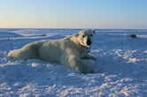
One colony photographed by the research team consists of about 300,000 penguins located at Cape Crozier. Another colony with about 3,000 nesting pairs is located at Cape Royds.

Schmidt described a colony of Adélie penguins as “a bustling metropolis” and “an intense concentration of energy” where fluffy chicks run about and couples race against the elements to raise their offspring before the sun sets for winter.
“There is drama, comedy, brutality,” Schmidt said in an interview. “Because they mostly ignore humans, we have this incredible opportunity to be guests in their world, to observe as they go about their busy little lives, surviving and thriving in the harshest of environments.”
The research team used an algorithm that made for the most efficient sweeping paths over the colonies and involved less backtracking than a human-piloted drone survey, according to the paper authors.
Researchers divided the area into a grid, while the algorithm considered a drone’s battery life, wind, altitude and even a safe path to base camp if the aircraft ran into trouble.
Schwager, lead author of the paper, didn’t get to go on the trip. But he said the aerial surveys prove the practical need for autonomous drones in a harsh environment like Antarctica.
“Just moving all of that equipment down to a remote site and being able to prepare it, field it and deploy it with nothing other than tents and a small warming hut at your disposal, that's really phenomenal," Schwager said in a statement.
Shah said the hard work paid off as they started to see the images start to come in from the field.
“We could see people walking around the colonies and all the individual birds that were nesting and coming to and from the ocean,” said Shah. “It was incredible."
The research team was done in collaboration with the National Science Foundation and U.S. Antarctic Program. A smaller team expects to return to Antarctica this year and a refined AI program will be used to study the images and count the chicks and adult penguins in the colonies, said Schmidt.
Other uses for unmanned drones are in the works, including monitoring traffic, disaster management, terrain mapping and wildfire surveys.
“In the end, we are passionate about using groups of autonomous drones to help people understand, manage, and protect the natural environment around them," Schwager said.
Subscribe to Closing Arguments
Sign up for new weekly newsletter Closing Arguments to get the latest about ongoing trials, major litigation and hot cases and rulings in courthouses around the U.S. and the world.