 Search Articles

SACRAMENTO, Calif. (CN) — As weeks of rain that brought relief from California’s historic drought give way to what may be weeks of dry weather, some scientists think a solution to saving precious water may lie in canals buried deep within the Central Valley — formed after the last Ice Age.
Climate change has brought intensifying swings between extreme drought and extreme floods to the Golden State, which new research suggests has limited options to use floods to recharge increasingly depleted underground aquifers. One option is to set aside vast tracts of land to channel floodwaters, and another is to find land that can quickly pass large amounts of water into rapidly drying aquifers.
The Central Valley faces dire risk of flooding when atmospheric rivers hit cities and rivers restricted by levees. It is also the region most dependent on groundwater for human survival given its status as the world’s breadbasket — groundwater that has been badly depleted in recent years.
UC Davis’s Graham Fogg and Stanford University’s Rosemary Knight spent years researching how the state can actively capture water rather than passively waiting for storm solutions. The Central Valley may contain riverbeds buried centuries ago in glacial melts, filled with coarse sand that is exceptionally porous and capable of rapidly moving heavy rains underground.
Fogg says these “paleo valleys” of clay and silt are so permeable that they can absorb up to 60 times more water than the rest of the valley floor. Knight describes them as “nature’s storm drains” to rapidly move large amounts of flood water deep into groundwater basins.
Fogg believes the paleo valleys could be the key to saving California’s water. If the state can identify paleo valleys throughout the subsurface, it could replenish groundwater depleted by agricultural over-pumping, and use aquifer capacity to rapidly store and recharge. Knight says a 2017 capacity study and The Nature Conservancy estimated 140 million acre-feet — the equivalent to 31 lakes the size of Lake Shasta — of groundwater storage space is available, while the surface has about 42 million acre feet, or nine Shastas, California’s largest human-made lake and the crown jewel of the state’s water delivery system.
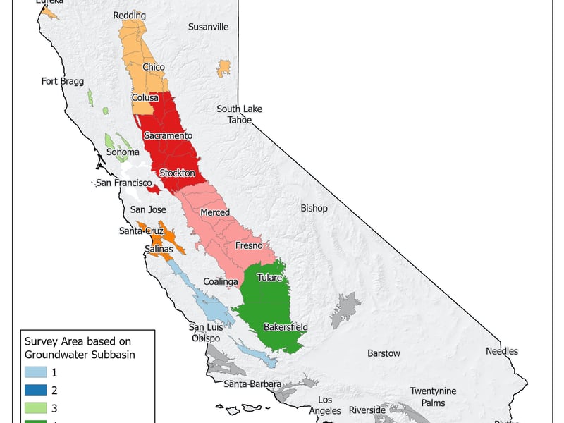
Fogg and Knight have discovered three paleo valleys and are determined to find at least a dozen more. The California Department of Water Resources is completing a three-year airborne land survey to finish that task, investigating if every river flowing from the Sierra Nevada has a paleo valley. as Fogg believes.
“If the state can divert 5% of current floods, that would be in theory enough water to balance California’s water budget,” Fogg said. “The problem is, how do you divert and get that water underground?” He said groundwater recharge is a yearslong process as stormwaters seep through layers of land to reach aquifers. But it could be sped up by finding the paleo valleys.
Before the Sustainable Groundwater Management Act was signed requiring local water districts to draft plans for sustainably managing groundwater, Fogg said the state was not as invested in water management. Now, subsurface mapping is a big part of the work.
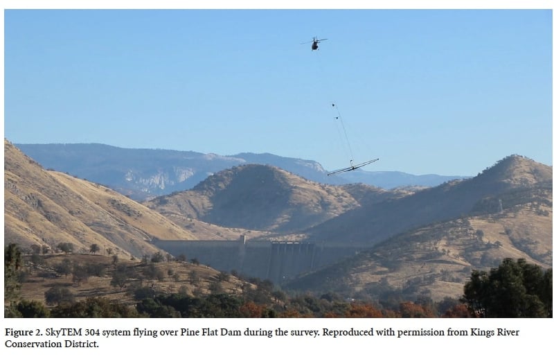
Knight said in 2015 she approached the state about her airborne geophysical studies, developed over seven years to find “super paleo valleys” — larger land features with very coarse sediments. The state agreed to collect data from all groundwater basins to map out the system’s structure.
“It’s like high-tech treasure hunting,” Knight said. “What we are hoping now is that data such as these can be acquired along the valley edge where there are rivers that could also mark locations for more of these super paleo valleys.”
UC Davis hydrology professor Helen Dahlke, vice chair of the state Department of Land, Air and Water Resources, said if the state can identify paleo valleys, water districts can develop plans for where to direct high-magnitude flows.
As leader of the Strategic Initiative for Water Quality, Quantity and Security, Dahlke said it could be difficult to convince land owners, already resistant to orders to pump less groundwater. However, she thinks they can understand how the strategy can solve dire water supply problems and mitigate land subsidence — sinking ground caused by overpumping groundwater.
Some are skeptical. University of San Francisco climate change and environmental justice professor Alice Kaswan said land use controls could make it difficult to get governmental entities on the same page.
“Land use controls often lie with local governments, while counties, water districts and the state are responsible for water management,” Kaswan said. “Given how much is at stake, the players themselves may have a strong incentive to work together.”
Tim Stroshane, Restore the Delta policy analyst, said he has not seen a clear argument showing the potential storage capacity from this mode of underground diversion.
“I am skeptical of the idea for lack of proponents making a stronger case as to where and how much potential storage is involved,” Stroshane said. “There is another matter, and that is who will be entitled via water rights to pump and use these supplies, and where?”
Dahlke acknowledged that land use rights, in a state with very old water rights, will be a major barrier. There are state mechanisms to enable diverting water when it presents great risk, but land use must be negotiated before diverting water to recharge aquifers. Land must be conserved for recharging, and cities and counties may resist not using it for commercial or housing purposes.
Dahlke said agencies can work together to estimate where thousands of feet of water could be placed each year, starting with a pilot to convince the most resistant parties. She said people should understand that the status quo is doing nothing — except depleting groundwater rapidly.
“We’re not thinking and we’re not smart about really intentionally trying to capture all water to help all groundwater resources,” Dahlke said.
UC Davis professor Thomas Harter, chair of the Hydrologic Sciences Graduate Group, said land owners need to understand paleo valleys could be “supercharge” locations to charge the overall groundwater system “battery.”
“They allow for that water to not only fill the valley, but also do the spreading out of that recharge into the entire system,” Harter said. But he also thinks that pressure to comply with Sustainable Groundwater Management Act will motivate people with a structure that may help compensate land owners.
Anyone can access the state’s interactive report of recently collected data on the valley floor. Within the next six months, experts will interpret the data for future projects, according to Tim Godwin, a technical and policy adviser for the Sustainable Groundwater Management Act project.
The state is already expediting other groundwater recharge projects to expand capacity by at least 500,000 acre-feet, using volunteers in the Flood-MAR program to analyze flow management. Godwin said once data interpretation from geomapping the valley is done, the state can launch pilot programs to determine how to move large amounts of water through paleo valley sites.
He thinks the state will expedite the paleo valleys project in the race to design strategies for supporting California’s water resiliency, “so we can better leverage the water when it’s available and put it in storage for when it’s not available.”
 Follow @nhanson_reports
Subscribe to our free newsletters
Our weekly newsletter Closing Arguments offers the latest about ongoing trials, major litigation and rulings in courthouses around the U.S. and the world, while the monthly Under the Lights dishes the legal dirt from Hollywood, sports, Big Tech and the arts.