 Search Articles

Forecasters warned of catastrophic damage from an “unsurvivable storm surge” reaching from Texas to Louisiana.
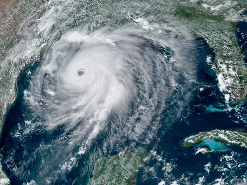
(CN) — Hurricane Laura has strengthened into an “extremely dangerous" Category 4 storm as it moves closer to landfall, National Hurricane Center forecasters warned Wednesday afternoon.
The forecast said catastrophic storm surge, extreme winds, and flash flooding would begin Wednesday evening along the Gulf Coast.
“This is a life-threatening situation. Persons located within [at-risk] areas should take all necessary actions to protect life and property from rising water and the potential for other dangerous conditions. Promptly follow evacuation and other instructions from local officials,” the bulletin states.
As of 2 p.m. Central, Laura was located about 200 miles south-southeast of Lake Charles, Louisiana, and was moving northwest at 16 mph.
Winds had increased to 140 mph with hurricane force winds extending up for 70 miles and outward for 175 miles.
The forecast said storm surge and tropical storm-force winds would arrive within the warning areas well in advance of Laura’s center.
“All preparations to protect life and property should be rushed to completion in the next few hours,” it said.
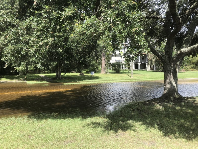
The National Hurricane Center update went on to say that high tide will cause normally dry areas near the coast to be flooded by rising waters as they move inland from the shoreline.
“Unsurvivable storm surge with large and destructive waves will cause catastrophic damage from Sea Rim State Park, Texas, to Intracoastal City, Louisiana, including Calcasieu and Sabine Lakes,” the report said. “This surge could penetrate up to 40 miles inland from the immediate coastline, and flood waters will not fully recede for several days after the storm.”
The sheriff’s office of Vermillion Parish, a coastal area in Louisiana’s Cajun country that is located roughly 150 miles each between New Orleans and Beaumont, Texas, issued a dire warning Wednesday asking residents to “please evacuate.”
“Those choosing to stay and face this very dangerous storm must understand that rescue efforts cannot and will not begin until after the storm surge has passed and it is safe to do so,” the warning posted on Facebook said. “Please evacuate, and if you choose to stay and we can’t get to you, write your name, address, Social Security number and next of kin and put it [in] a Ziploc bag in your pocket. Pray that it does not come to this.”
Much of the southern portion of Vermillion Parish has been washed away in recent decades by water erosion, particularly following Hurricanes Katrina and Rita in 2005.
Meanwhile, officials in Grand Isle and Port Fourchon, Louisiana, warned Wednesday afternoon that rising water along the coast had already swamped portions of LA 1 and other roads outside the levee system and could potentially cut off Grand Isle and Louisiana’s main oil port for days.
Port Fourchon, which is the service hub for most of the offshore oil and gas production in the northern Gulf of Mexico, could be facing its longest closure ever, according to a report published Wednesday by Nola.com.
The port, on the south tip of Lafourche Parish, was evacuated Sunday for Tropical Storm Marco and may not reopen until later this week.
Forecasts from the National Hurricane Center warned of storm surge and tropical storm conditions as far east as Ocean Springs, Mississippi.
Already Tuesday afternoon – as an aftereffect of Tropical Storm Marco and preview of Hurricane Laura – Lake Pontchartrain on the outskirts of New Orleans had risen several feet.
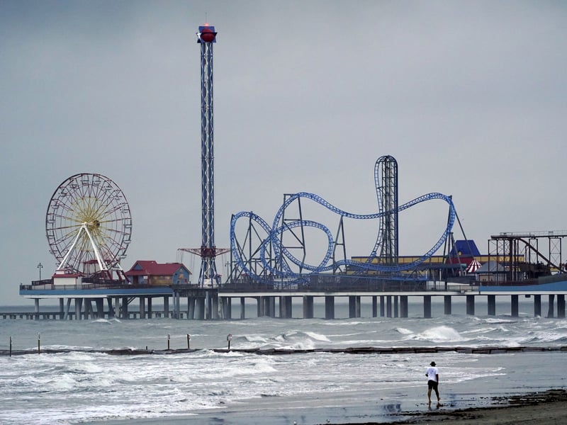
Home and business owners throughout the region are nailing plywood over their windows and many are complying with calls to evacuate, while others are hunkering down, saying they have nowhere else to go.
Texas Governor Greg Abbott urged East Texans to avoid fast-moving floodwater. The National Weather Service says less than 6 inches can knock one down and 2 feet will float a car, and 90% of all hurricane-caused deaths involve water.
“It can easily sweep you away, causing you to lose your life,” Abbott said in a briefing.
Power companies in the Houston area are preparing to deploy linemen to fix downed power lines as Abbott said in addition to the wind, Laura will likely whip up tornadoes.
Harris County’s chief executive Lina Hidalgo on Tuesday afternoon asked thousands of residents in a wide swath stretching from downtown Houston, the county seat, to its eastern and southern borders to voluntarily evacuate.
Harris and neighboring Fort Bend County have waived toll-road fees so as not to impede evacuations.
The Port of Houston, which includes the Houston Ship Channel, closed its terminals Wednesday and Thursday.
Environmental experts say a worst-case scenario for the region would be a 25-foot storm surge ripping up the channel, uprooting chemical and oil-storage tanks at the numerous plants and refineries on its banks and washing the sludge down to Galveston Bay and into the living rooms of surrounding homes.
But meteorologists on Wednesday morning said their models show Laura coming ashore around Beaumont and Port Arthur, Texas, near the state line, where they warn the storm surge could reach 30 miles inland.
The impending storm coincides with the three-year anniversary of Hurricane Harvey, whose record rainfall inundated Houston, flooded thousands of homes and forced many Houstonians onto their roofs where they were rescued by Coast Guard helicopter crews, a replay of the disaster wrought in New Orleans 15 years ago by Hurricane Katrina, which overwhelmed New Orleans’ levees and drowned 1,200 people.
Both storms caused an estimated $125 billion in damages.
Many Houston residents are still repairing home flood damage from Harvey or are still displaced by the storm, unable to return to their mold-infested homes.
But Louisiana Governor John Bel Edwards said Tuesday that Laura most closely resembles Hurricane Rita, a Category 3 storm that made landfall at the Louisiana-Texas border in September 2005 with 120 mph winds.
Fearing Rita would wreak as much destruction as Katrina had a month earlier, more than 3 million people in the Houston area fled north and west, and the traffic overwhelmed freeways. Many drivers were stranded when they ran out of gas as temperatures climbed into the triple digits.
The traffic was so bad it took evacuees an average of 24 to 36 hours to reach Dallas, typically a 3.5-hour trip. Longtime Houstonians point to that disaster as proof it is best to hunker down for hurricanes
Rita unleashed 90 tornadoes and left seven people dead and $10 billion in property damage in its wake, according to the National Hurricane Center.
Governor Abbott assured Texans the hurricane will not disrupt progress the state has made this month in containing the pandemic. The number of people hospitalized with Covid-19 fell below 5,000 on Tuesday for the first time since June, the Texas Tribune reported.
He said the state will deploy more buses for hurricane evacuation than it typically does so passengers will have room to stay 6 feet apart, with hand sanitizer and face masks on board, and the state will send teams to shelters to test evacuees for the virus.
Schools in southeast Texas and southwest Louisiana have canceled classes for the rest of the week after many of them started their academic years Monday with online classes.
Of Houston Independent School District’s 209,000 students, nearly 80% are economically disadvantaged, meaning they qualify for free lunch or other assistance. Because its campuses are closed, the district has been supplying meals for students through curbside pickups and delivering them to apartments.
The district, the state’s largest, canceled its food giveaways for Thursday and Friday as all eyes turn to the Gulf of Mexico.
 Follow @cam_langford
Subscribe to our free newsletters
Our weekly newsletter Closing Arguments offers the latest about ongoing trials, major litigation and rulings in courthouses around the U.S. and the world, while the monthly Under the Lights dishes the legal dirt from Hollywood, sports, Big Tech and the arts.