(CN) – After a slow start to the season, a series of January storms bulked up California’s snowpack to nearly normal with more precipitation on the way.
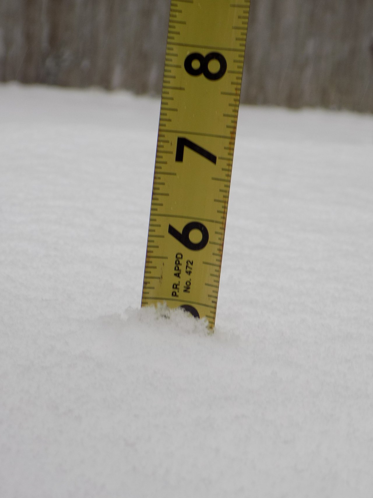
The February snow survey conducted by the California Department of Water Resources at Echo Peak near South Lake Tahoe on Thursday yielded good news: The snowpack is 98 percent of average, and its water content looks positive as well.
“It’s very encouraging,” said John King, an engineer with the department. “Especially when considering we’ve had a couple dry years and we have two months to go.”
With its Mediterranean climate of hot dry summers and mild moist winters, California relies on the snowpack that accumulates in the Sierra Nevada for two-thirds of the water that is distributed throughout the state via a series of dams, pumps and canals.
The quantity of snow that falls in a given year determines whether an almond farmer in the Central Valley will get enough water to see his orchard through another productive cycle.
“Typically, California relies on a handful of large storms like we saw earlier this year.” said Department of Water Resources director Karla Nemeth. “It’s a start, but the next two or three months will determine what it means for our reservoirs and overall water supply.”
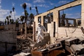
From about 2012 to 2017, California experienced one of the worst droughts in state history, The effects of that drought live on – economically for farms, and ecologically through dead trees, pest infestations, dwindling fish populations and low moisture content in vegetation which has caused some of the worst wildfires in the history of California and the United States.
Recent history wasn’t kind to California water managers either, as this time last year the snowpack hovered around 27 percent of normal and 44 percent of the Golden State had slipped back into drought.
But a Miracle March ensued, propelling precipitation levels to near their average.
Given the variable weather patterns in California and the specter of rising global temperatures, which can cause more rapid snowpack melting sooner into the season, water managers in the state are reluctant to rejoice even with Thursday’s good measurement.
And when the melting begins sooner in the season, wildfire season lasts longer. A recent study conducted by the University of California, San Diego, found wildfire season now pushes into autumn and coincides with seasonal wind events like the Santa Anas in Southern California and the dry north winds in Northern California – amplifying the size and severity of fires that break out.
While officials are hopeful that a new track of storms can help ease the water content situation in the forests and provide enough water for farmers and fish, two months remain until the all-important April 1 snowpack measurement.
“That’s typically the date of maximum snow accumulation,” King said.
The state is already 71 percent of the way there, and with the storm track again pointed at California good news may prevail in April as well.
 Follow @@MatthewCRenda
Subscribe to Closing Arguments
Sign up for new weekly newsletter Closing Arguments to get the latest about ongoing trials, major litigation and hot cases and rulings in courthouses around the U.S. and the world.