


BAKERSFIELD, Calif. (CN) — After an unexpected wet winter, California’s drought-addled Central Valley now faces dangerous floods as a historic snowpack melts — even as the state moves to store the liquid gold as quickly as possible.
Once the largest freshwater lake west of the Mississippi River at about 650 square miles, it hosted a diverse ecosystem and many Indigenous people. When the lake dried as rivers were diverted for cities and farming, agricultural communities appeared thanks to the rich soil.
Today, the basin spans several counties and produces more than half of the state’s agricultural output, according to the Public Policy Institute. Those crops account for 97% of regional water use, often relying groundwater pumping in dry years.
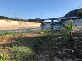
Without an outlet to the ocean, water normally leaves the basin through evaporation and agriculture. The lake occasionally reappears in particularly wet years. Snowpack from recent storms melts into about 4 million acre-feet of additional runoff, leaving 103,000 acres underwater. Communities within the Tulare Lake Basin will be on flood alert well into July.
UC Davis professor Thomas Harter, Hydrologic Sciences Graduate Group chair, said whiplash from drought to floods makes water management very challenging. Local agencies must negotiate with farmers about capturing water, and finding land where it can soak into the ground — called recharge basins.
“The looming question with the snowpack sitting up there is, is there a way we can store this water for a drier year?” he said. “The basin’s shortfall is not going to go away.”


Tricia Stever Blattler of Tulare County Farm Bureau said the agricultural community is too focused on keeping their heads above the water to rejoice about drought relief.
In March, many miles of farmland and roads were covered in water. Months later, landowners face financial losses — at least $160 million in reportable losses in Tulare County alone, Blattler said. And their fields remain flooded.
Some landowners are already diverting flood water to help it soak underground, off to aquifers to recharge depleted groundwater storage, Blattler said. They are using Governor Gavin Newsom's executive order allowing people without water rights to divert floodwater away from communities, off to basins or fallowed land.
“We are totally at the mercy of needing to comply with the Sustainable Groundwater Management Act as part of any recovery effort,” she said, referring to the law that requires local groundwater sustainability agencies to develop and implement plans to bring critically overdraft groundwater basins into balance by 2040.
On May 17, Newsom signed an order to send Kern River overflows into the California Aqueduct, which eventually flows to Southern California. Daniel Wisheropp of the State Water Project said this is the first time the diversion point, called the Kern River Intertie located west of Bakersfield, has been used since 2006.
Mehdi Mizani, manager of Tulare Lake Basin's planning unit, said the areas most likely to flood will reach peak inundation levels by May 31. The most at-risk areas could see about 117,000 more acres under water.

Meanwhile, California plans to boost the number of facilities and acres where floodwater can be diverted to seep into the ground, recharging aquifers.
The state Department of Water Resources' sustainable groundwater management deputy director Paul Gosselin said California has enough land to recharge about 4 million acre-feet of water, and could add nearly 300,000 acre-feet through new recharge projects. The average U.S. household uses about an acre-foot of water a year.
The state has $2 million for “rip and chip” projects — fallowing cropland into permanent recharge lands — and restoring flood plains. Flood plains take water from overflowing rivers, relieving pressure on levees and helping water move underground. Nearly 3,000 recharge basins are active in the valley, with more than 100 operated by Kern River Water Authority in Bakersfield to divert water from Kern River and the California Aqueduct and put it back into the ground.
But residents worry agencies are not moving fast enough to prioritize the replenishment of domestic wells and that private agricultural interests may use the lion's share on crops.
This year, Melynda Metheney’s community in West Goshen finished connecting all residents to Cal Water after more than a decade of demanding clean water. Metheney said residents worry that authorities allocating the runoff will prioritize farms.
“They really should be allocating it to residents and to private wells, to at least to get them through for a little while until we can figure out what’s going to happen," she said. "But I don’t think that’s going to happen. At the end of the day, money talks.”

Jeffrey Mount, founding director of the Center for Watershed Sciences and Public Policy Institute fellow, said if water permitholders want to save land for crops, the state may pressure them not to pump groundwater this year.
The institute posited that although San Joaquin Valley authorities don’t want state oversight, recent floods show that counties need local cooperation agreements on what to do when rivers overlapping county borders overflow.
Mount said he thinks this year is a test run — for California to establish more effective water management strategies, and for water rightsholders to adapt and avoid losing precious new water.
“What we haven’t grappled with is that it takes extraordinary discipline not to use all of the available water,” Mount said. “We’re still figuring this out.”
Harter said it is not impossible for agencies to establish successful partnerships with landowners and secure land for capturing water. He pointed to the example set by McMullin Area’s groundwater agency in Fresno County, partnering with landowners to make the region a water bank.
But Helen Dahlke, an integrated hydrologic sciences professor at UC Davis, is more pessimistic. Most senior water rightsholders want to see water captured in reservoirs and are hesitant to continue making cuts.
“They do whatever is in their economic interest,” Dahlke said. “It is not in line with protecting, for example, the impoverished communities.”
Dahlke said although the state has some oversight, it is not clear how practices in regions whose groundwater management plans were rejected will change. But court battles appear likely.
“The losers, of course, are going to be people that are relying on shallow domestic wells and groundwater for their water supply," Dahlke said.
"I’m not sure how we’re going to solve the politics of this. People have to come together and want to do this.”

 Follow @nhanson_reports
Subscribe to Closing Arguments
Sign up for new weekly newsletter Closing Arguments to get the latest about ongoing trials, major litigation and hot cases and rulings in courthouses around the U.S. and the world.
Additional Reads

-
-
 DOJ announces new crime gun intelligence center in Chicago April 17, 2024